
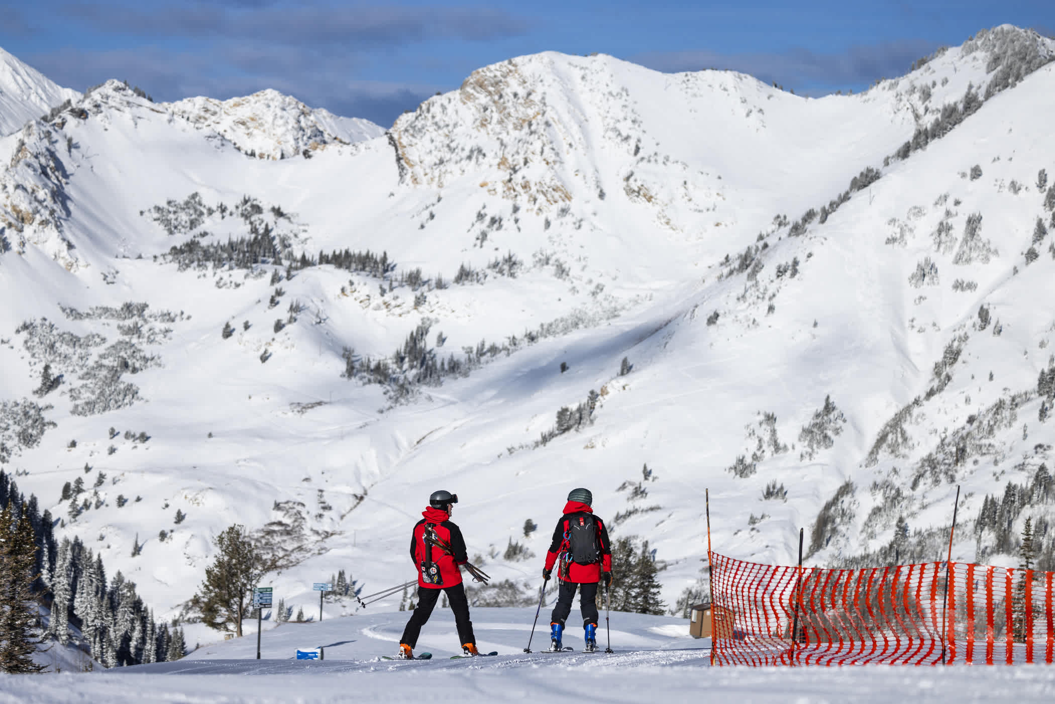
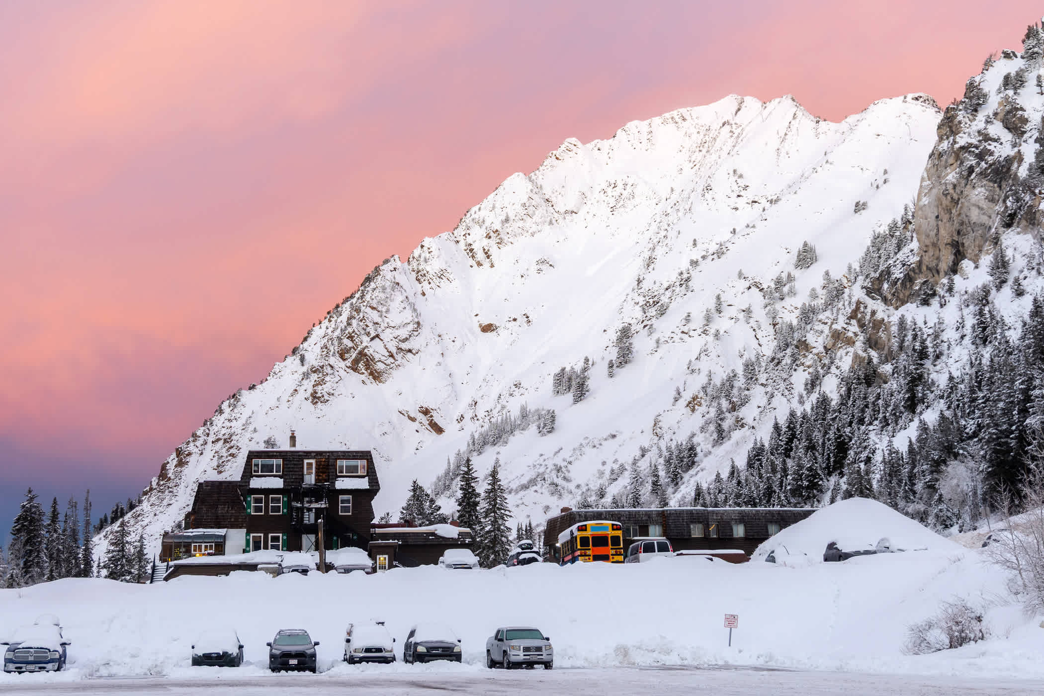
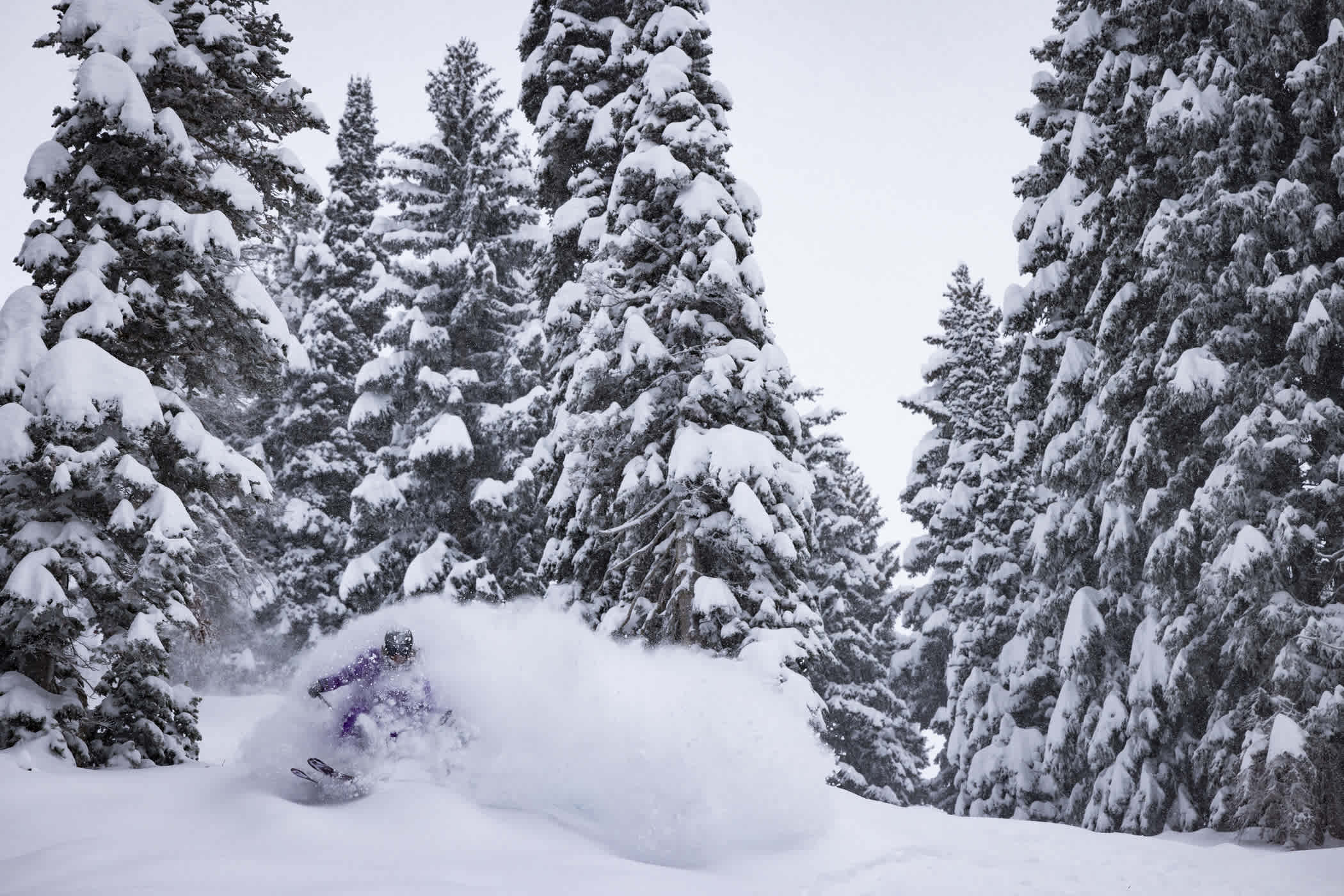
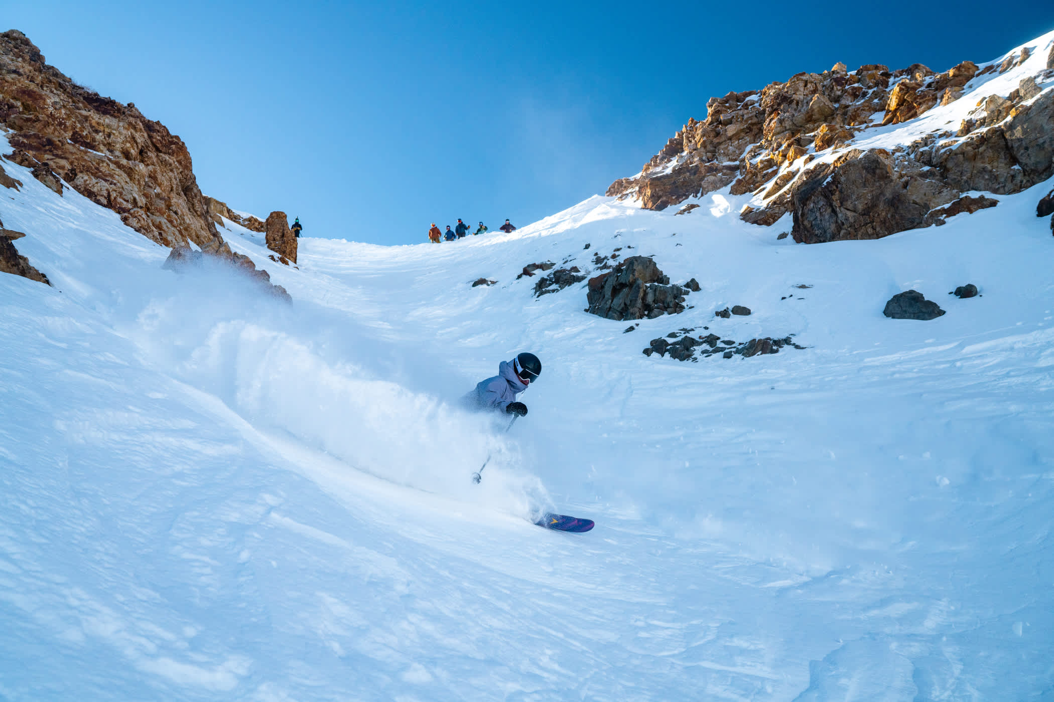
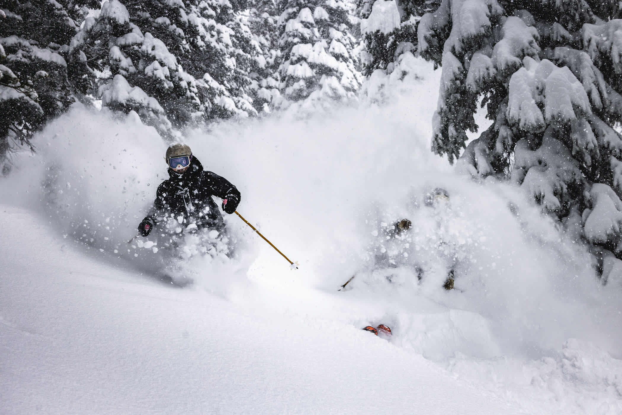
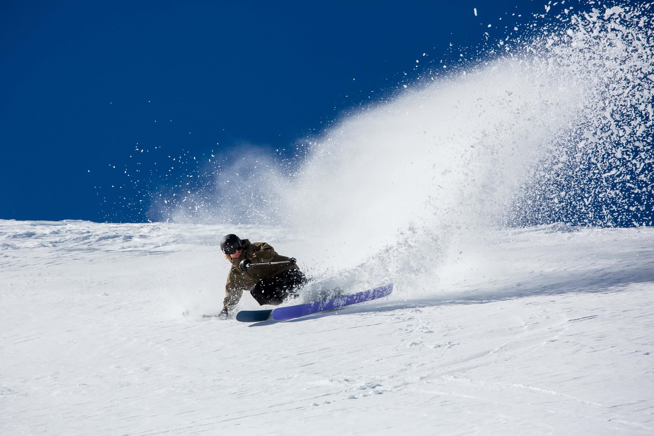
If this is as bad as it gets, we have it pretty good.
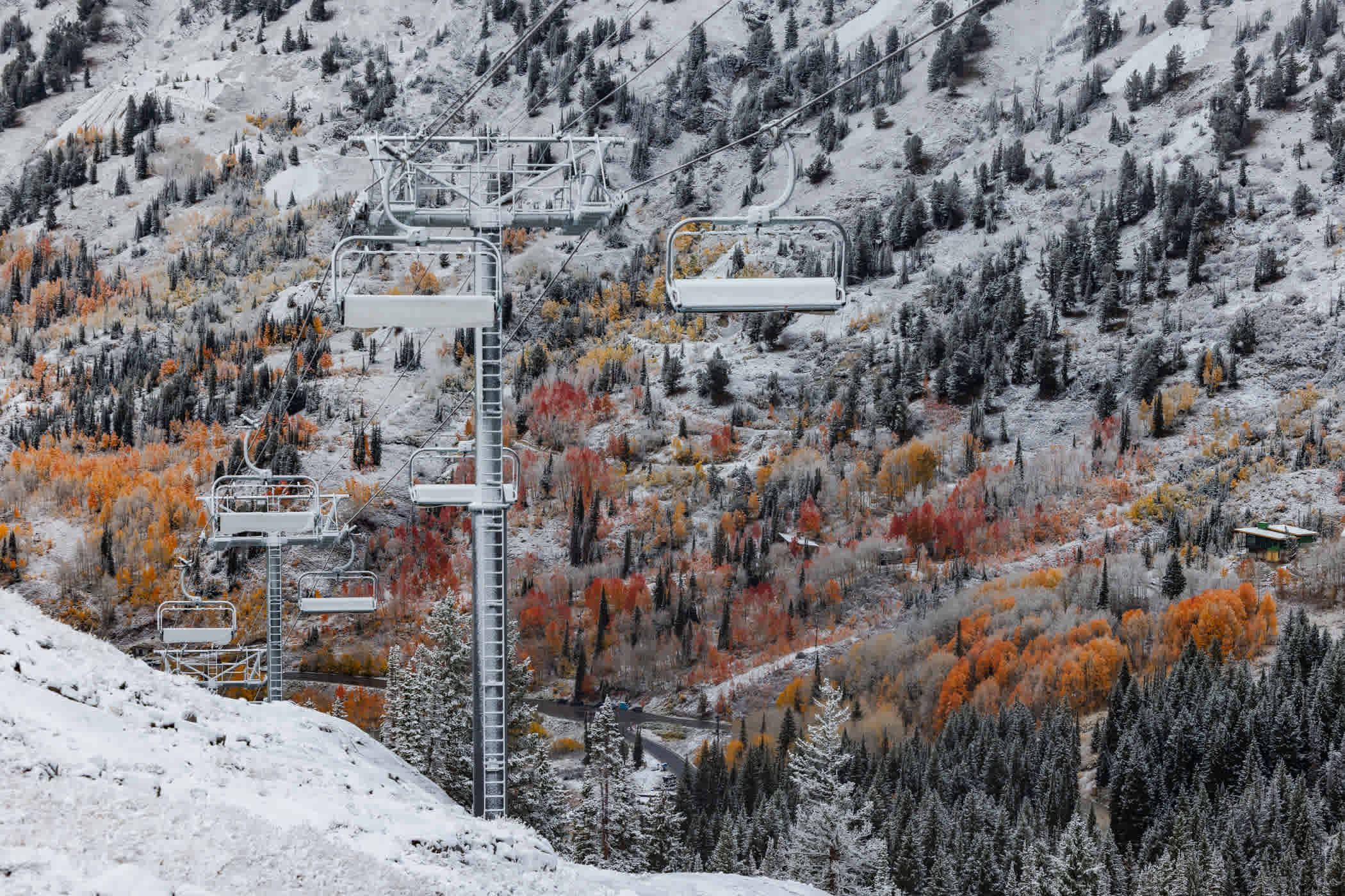
Entering our 88th year, we envisioned a normal Alta season—month after month of snowy nights and deep days. Slopes of Alta marked with fresh tracks of celebratory powder 8s—and powder 88s—waiting to be erased by the next round of snowstorms. Mother Nature had other plans.
A Very Slow Start
A wet and wild October gave way to a meh and mild November as temperatures warmed and storms fizzled en route to the Wasatch. November 2025 was the least-snowiest on record. Snowmaking opportunities were scarce. Thanks to the hard work of our staff and a well-timed, base-building storm, we managed to open for the season on December 7th with just 54.5 inches of season-to-date snowfall. A few more dense December storms brought fresh snow through the holiday season and the New Year started with a bang. But much like a firework show ringing in a new year, the sky filled with a flurry of activity, and then nothing.
Snowless weeks were finally punctuated by a few inches that breezed through in the waning days of January. The high pressure continued into the first week of February. We were quietly enjoying some pretty great skiing. Not deep powder, but the low sun angle of midwinter kept the snow cold, the groomers fresh and the off-piste chalky.
Winter Was Here—Until It Wasn't
The second half of the season got off to a strong start as a President's Week storm—the biggest storm cycle of the season—dropped 53 inches of snow in 100 hours. The weather stayed active through the end of the month and into the first week of March. Between February 16th and March 6th, over 100 inches of snow blanketed Alta Ski Area. It looked like winter was here to stay—until it very much wasn't.
March roared in like a lion before unseasonably warm temperatures settled in throughout the West. Spring Fever persisted for three weeks—an early start to spring break that forced resorts across the West to call it a season. The spring skiing vibes were high, and thanks to Alta's high-elevation and mostly north-facing terrain, the snowpack managed to hang on through the heatwave.
Ending the Season on a High Note
Colder temperatures and snow returned by the end of March and into early April. The final month of our 88th season delivered a great mix of storm skiing, powder days, sunshine and slush bumps. Alta Ski Area closed for the season on Sunday, April 26th. The final day of the season was a wild and festive 15-inch powder party—an unexpected final powder day to close out an unusual season. The lifts turned off for the season with an 88-inch settled snow depth.
Despite the Closing Weekend powder days, the Collins Study Plot recorded just 321 inches of seasonal snowfall—beating out the 2014–15 season (323.5 inches) for the dubious distinction of the least-snowiest season in the 46-year history of the Collins Study Plot.
At just 321 inches, the 2025–26 season was Alta Ski Area's least-snowiest season on record.
Reliving the 2025–26 Season | 321 inches.
Let’s do a deep dive into our not-so-deep seasonal snowfall stats and our Photo of the Day Archive to see how this season compares to the months and winters in Alta’s storied—and snowier—history.
- October 2025 | 14 inches of snow—53.2% of average
- November 2025 | 14.5 inches of snow—20.5% of average
- December 2025 | 45.5 inches of snow—50.5% of average
- January 2026 | 69 inches of snow—72.5% of average
- February 2026 | 72.5 inches of snow—79.5% of average
- March 2026 | 51 inches of snow—51.7% of average
- April 2026 | 54.5 inches of snow—72% of average
October 2025 | 14 inches of snow—53.2% of average
Snow arrived early on the slopes of Alta as several inches of snow fell atop the fall foliage in early October. A few days of warm weather followed and the snow melted its way into Little Cottonwood Creek.
October 4th: First snowfall of the season | Photo: Rocko Menzyk
Another series of storms mid-month brought 14 inches of snow and colder temperatures. Our snowmaking crews tested out our upgraded snowmaking lines before warm weather returned through the end of the month. A few inches of settled snow remained at the Collins Study Plot on November 1st.
October 16th: A foot of snow in mid-October | Photo: Adam Fehr
October snowfall that contributed to the season’s base on November 1st totaled 14 inches, 53.2% of the 45-year October average of 26.31 inches. October water totaled 2.35 inches, 78% of the October average (3.0”).
November 2025 | 14.5 inches of snow—20.5% of average
Warm and dry weather kicked off the new month as a stubborn ridge of high pressure forced multiple storms to split on their way to the Wasatch. Snowfall either missed Utah completely or delivered meager snowfall from the scraps of storms. Unseasonably high snow levels and wet bulb temperatures prevented our snowmaking teams from firing up the snowguns as we approached our projected Opening Day of November 21st. The decision was made to delay the start of our 88th season.
November 18th: Collins Gulch before our projected Opening Day | Photo: Rocko Menzyk
The delayed start to the season provided a unique opportunity to enlist our employees' help in an inaugural Winter Essentials Drive, as a way to help families in need during the holiday season—and maybe score a little goodwill with the snow gods. Working with local nonprofits, Alta skiers and community members recycled old ski gear and donated truckloads of food and winter clothing to those in need. As the final boxes of canned food were loaded up, the snow started coming down.
The final day of a dry November witnessed the return of cold air and a quick-hitting storm. The biggest storm of the month dropped 10 inches of low-density snow on the sparsely covered slopes of Alta. Our snowmaking and snowcat teams went to work grooming corridors and building up the base areas.
November 30th: Building the base | Photo: Adam Fehr
In total, November snowfall was 14.5 inches of snow, 20.5% of the 45-year November average of 70.62 inches. November water totaled 1.41 inches, 22.9% of average (6.15”). November 2025 was the least-snowiest November in the 46-year history of the Collins Study Plot.
December 2025 | 45.5 inches of snow—50.5% of average
Under cold temperatures and with a little fresh snow, our snowmaking and snowcat crews worked around the clock through the first few days of December. By Wednesday, December 3rd, a corridor had been groomed in Collins Gulch. Alta Ski Patrol went to work performing avalanche mitigation, setting up tower pads, signs and ropelines. The Alf Engen Ski School conducted ski evaluations for new hires. Preseason preparations that are typically completed over two weeks in mid-November were completed in two days, just as an atmospheric river took aim at the Wasatch.
The storm started on the morning of Friday, December 5th and raged through the night and into the next day. When the clouds broke Saturday evening, Alta Ski Area was spackled in 19.5 inches of snow from nearly three inches of water—exactly what we needed to jumpstart our season.
December 7th: Alta Ski Patrol finishing setup | Photo: Rocko Menzyk
Opening Day of our 88th season was Sunday, December 7th—featuring top-to-bottom skiing on Collins and Sunnyside lifts. Patience with the delayed start to the season paid off with great coverage on groomed runs and soft snow in some off-piste areas.
December 7th: Opening Day of our 88th season | Photo: Rocko Menzyk
The first week of the season brought additional lift and terrain openings. Wildcat lift opened on Monday, December 8th. Westard Ho and the Tower 10 Traverse opened the following day. Sugarloaf lift opened on Saturday, December 13th, followed the first Ballroom and Baldy Shoulder rope drop of the young season.
December 8th: Wildcat powder day | Photo: Tyler Struss
Following 10 days of warm and dry weather, the first in a series of storms rolled into the Wasatch on December 17th. A cold front blasted its way through Little Cottonwood Canyon. Winds increased as graupel pellets hurled themselves at the mountain. Thunder and lightning ensued—forcing Alta Ski Area to close all lifts by 3pm.
The following morning, skiers flocked to the wind-buffed slopes and four inches of graupel. Adding an inch of water to the early-season snowpack, the graupel also created a fresh canvas for Alta skiers to leave fresh tracks in the soft snow. It also allowed Alta Ski Patrol to open the High Traverse, providing access to a large chunk of terrain in the High Country—including Greeley Bowl, Eagle's Nest and Alf's High Rustler—via the Race Course bootpack.
December 18th: Tommy Flitton explores the blank canvas | Photo: Rocko Menzyk
Another three inches of dense snow fell on the final day of fall, just enough coverage to open the newly aligned Supreme lift for the first time. Catherine's Area opened on December 21st, the Winter Solstice.
Santa Claus stopped by Alta on Christmas Eve to ski a few laps before heading out for the big night. As is tradition, the snow started falling shortly after his sleigh left Little Cottonwood Canyon. Snow levels started very high, but eventually one-and-a-half inches of snow fell from over an inch of water.
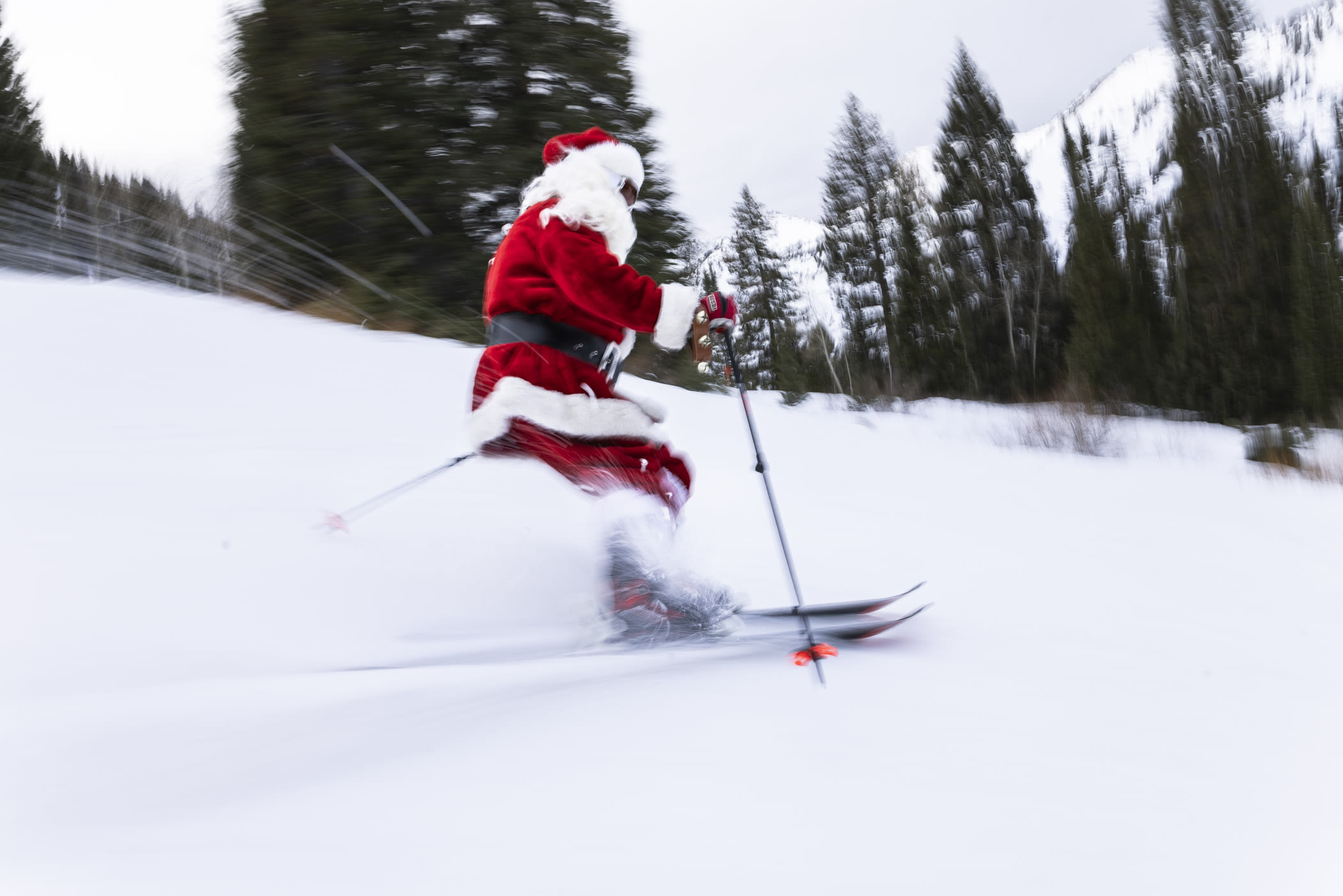
December 24th: Santa stopped by to deliver a White Christmas | Photo: Rocko Menzyk
Santa's delivery of true powder snow took a couple of days to materialize as temperatures finally began to recede to winter-like levels. The final storm of 2025 began as another round of graupel before transitioning to colder powder snow. By Sunday, December 28th, 15 inches of snow had fallen and our crews went to work opening as much terrain as possible. It wasn't the bottomless blower powder that we've grown accustomed to over the past 88 years, but after a warm and weird start to the season, it was a welcome return of soft snow.
December 29th: Ana Eyssimont dives into a bluebird powder day | Photo: Rocko Menzyk
Despite the slow start to the season, the well-timed storms throughout December helped us expand our groomed terrain and off-piste skiing. Our snowmaking and snowcat teams worked through the nights to put down fresh corduroy for holiday skiers to enjoy gliding through the mountains with family and friends. We celebrated the end of 2025 with our annual New Year's Eve Torchlight Parade and Fireworks event—the warmer weather providing a wonderful night in the mountains.
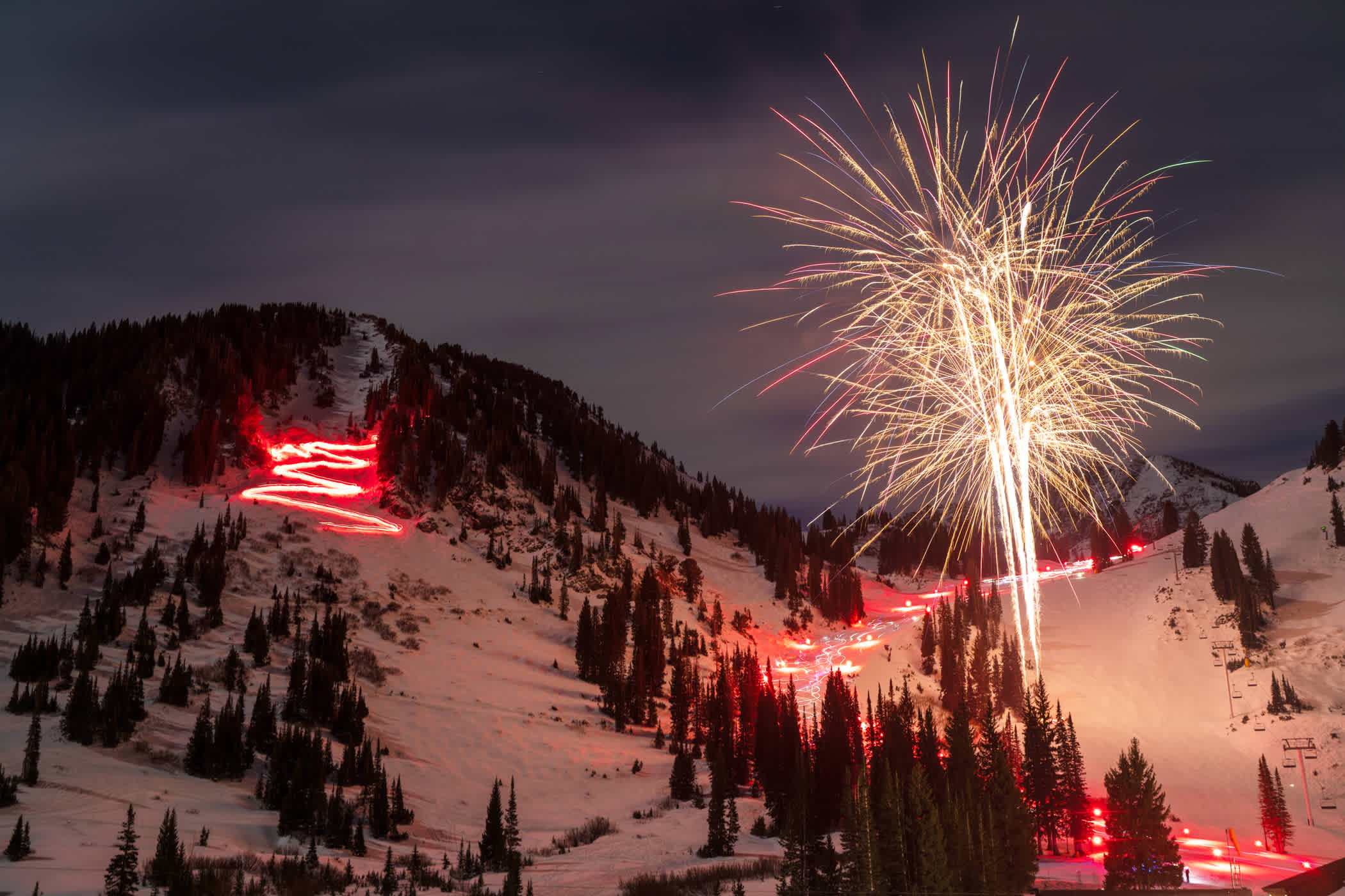
December 31st: NYE Torchlight Parade & Fireworks | Photo: Tyler Struss
In December, the Collins Study Plot recorded 45.5 inches of snow, 50.5% of the 45-year December average of 90.12 inches. December water totaled 7.21 inches, 99.6% of average (7.24").
January 2026 | 69 inches of snow—72.5% of average
Like confetti falling as the ball dropped, the New Year welcomed new snow. Four inches of dense snow accumulated by last chair and snowfall rates picked up overnight. By the morning of January 2nd, 16 inches of dense snow had blanketed Alta Ski Area.
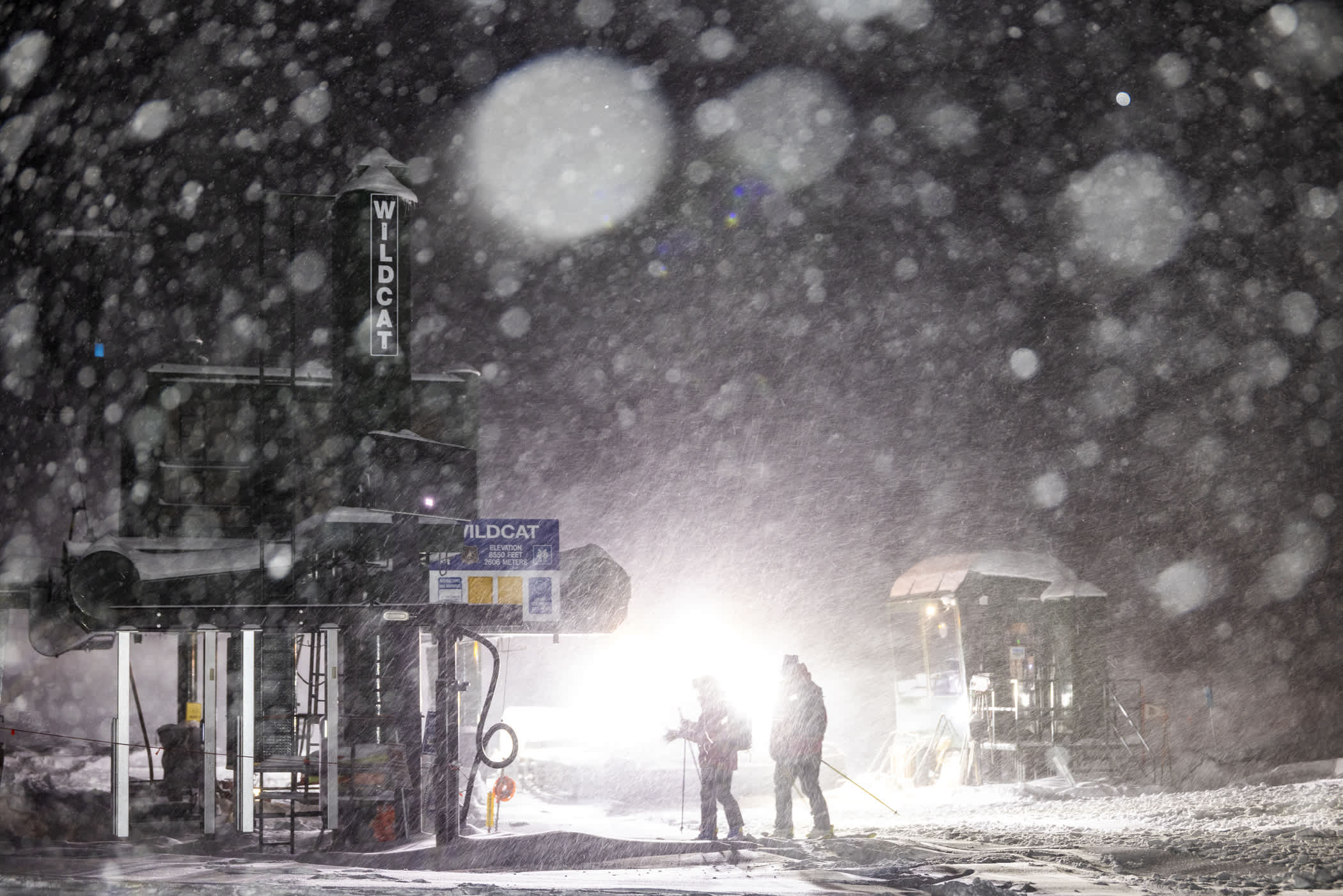
The new year started with a bang—literally. Just as Alta Ski Patrol was finishing avalanche mitigation, a power pole next to Wildcat lift succumbed to the weight of the new snow, triggering a display of blue sparks as the power pole snapped in half. The resulting power surge delayed Collins and Wildcat lift openings for a few hours while our crews worked to restore power.
January 2nd: Piper Kunst skis powder from Wildcat lift | Photo: Rocko Menzyk
On January 3rd, Alta Ski Patrol opened the High Traverse from the top, greatly expanding skiable acreage in the High Country. Alta's snowmaking and snowcat crews utilized the new snow and cold temperatures to expand groomed terrain in the Albion Basin and Collins Gulch. As the first weekend in January came to a close, a wet and wild storm arrived via a southwest flow.
January 3rd: A beautiful sunrise between storms | Photo: Photo-John
Maybe it was the New Year and a new snowfall trend, but snow levels were slightly colder than previous storms, and it wasn't long before graupel started accumulating quickly on the slopes of Alta. By the following morning, 15 inches of graupel and dense snow had fallen at the Collins Study Plot. As Alta Ski Patrol began performing avalanche mitigation, convective snowfall made its way up Little Cottonwood Canyon, throwing graupel, thunder and lightning at the mountains.
January 5th: Early morning for Alta Ski Patrol | Photo: Rocko Menzyk
Patrollers sheltered as the boundary front passed through, delaying avalanche mitigation and the opening of lifts for a few hours. The lightning subsided and all five lifts opened by noon. And then the snow started coming down again, peaking at three inches an hour before the clouds finally parted. It was a slightly delayed, but wonderful day of storm skiing.
January 6th: Taylor Pratt storm skiing after a lightning hold | Photo: Rocko Menzyk
On Tuesday, January 4th, the sky had turned blue and Alta skiers were treated to a bluebird powder day following a 29.5-inch storm. Alta's teams opened all five lifts, providing access to over 80-plus runs following rope drops in Ballroom, Baldy Shoulder the High Traverse, Supreme Bowl and Catherine's Area.
January 6th: Kalen Griffin and Jacqueline Pollard catch the High Traverse opening | Photo: Tyler Struss
A third storm in the first week of January ushered in a colder storm and a prolonged period of northwest flow—the ideal weather pattern for deep powder skiing at Alta. The snow started falling overnight, delivering seven inches of powder for first chair. After a lull in the morning, the flakes started stacking up around noon, and didn't want to stop.
January 8th: Georgie Knox bounces through blower powder | Photo: Rocko Menzyk
By last chair on January 8th, 14 inches of new snow had fallen. Just as it seemed the storm was done, lake effect kicked in, dropping another eight inches of snow overnight before the last wave of moisture had passed and the sky turned blue.
January 9th: Michael Cherchio dives into 22 inches of Alta Magic | Photo: Rocko Menzyk
In total, 22 inches of fluffy powder snow fell on the slopes of Alta. The new snow bumped our settled snow depth to 70 inches and season-to-date snowfall to 140.5 inches. It also made for a really great weekend of powder skiing as Alta Ski Patrol opened the Backside for the first time this season.
January 11th: Jack Garver catches a bluebird Backside rope drop | Photo: Photo-John
The storm moved on from Little Cottonwood and a stubborn ridge of high pressure took its place. But even as 66.5 inches of fresh powder turned to chalk, our skiable terrain increased, carrying us through a mostly snowless second half of January.
January 22nd: Jazz Vitale explores Supreme bumps | Photo: Rocko Menzyk
Following a warm, wet and weird start to the season, this stretch of calm weather provided plenty of opportunities to explore the mountain while building up our ski legs—one groomer, sidestep, traverse or bootpack at a time.
In January, the Collins Study Plot recorded 69 inches of snow, 72.5% of the 45-year January average of 95.18 inches. January water totaled 7.34 inches, 95.9% of average (7.65").
February 2026 | 72.5 inches of snow—79.5% of average
As February began, high pressure remained in place. From Westward Ho to Catherine's, from the top of Baldy to the bottom of the Big Griz ski conveyor, skiers were skiing everything—embracing the opportunity to explore new areas of the mountain and enjoying the slopes and runs often overlooked on powder days. On February 2nd, Alta Ski Patrol opened the Main Chute of Mount Baldy. For the first time this season, Alta Ski Area was open wall-to-wall—with 118 of 118 runs open and a 60-inch settled snow depth.
February 2nd: Berkley Stone finds fresh chalk in Main Chute | Photo: Tyler Struss
Between Super Bowl Sunday and Valentine's Day—the halfway point of the season—we received a heartwarming gift from Mother Nature. A cold front moved into Utah on Monday, delivering the first inch of February snow. The cold front helped open the door for another storm moving into Alta from the southwest. Seven inches of fresh snow fell overnight—our first true powder day in a month.
February 11th: Turner Barbour gets some long-awaited snow in the face | Photo: Tyler Struss
The storm picked up again overnight, dropping another four inches of dense snow before the skies cleared. The final four inches created a clean canvas across the mountain and Alta Ski Patrol opened additional terrain, the perfect opportunity to test the ski legs we've been building up throughout a dry January.
February 12th: Erin Spence remembered how to ski powder | Photo: Rocko Menzyk
Following a month of high pressure, a foot of fresh white paint was just what we needed to spruce up the place for the busy Presidents' Day Weekends. Our grooming teams went to work, dressing up Alta in fresh corduroy. Our lifties carefully manicured their ramps and liftlines. And Alta Ski Patrol freshened up the turns with additional terrain openings. On Valentine's Day, we grabbed our partners and laid down powder 8s in Devil's Castle. Romantic Alta was back and the forecast was looking quite lovely.
February 14th: Leo Schor and Eliza Cowie love some Valentine's Day Powder 8s in Devil's Castle | Photo: Photo-John
We kicked off the second half of the season as a cold winter storm moved into the Wasatch. In a season filled with near-misses from splitting storm cycles, dense snow, southwest flows and underproducing storm totals, we prepared for the worst. But the downgrade never came, the split never happened and Mother Nature hit us with everything she had.
A cold winter storm arrived on Presidents’ Day. Under blue skies and through blustery winds, skiers enjoyed an incredible day of wind-buffed turns on the Backside before clouds rolled in and graupel pellets began falling. The wind and graupel continued through the night and into the next day. By the last chair on Tuesday, almost a foot of graupel had accumulated around the mountain. The little ball bearings landed on the smooth chalky slopes of Alta, rolling into every nook and cranny, refilling ski tracks between laps.
February 17th: Thayne Rich surfs the graupel | Photo: Tyler Struss
After a short break in the action, the snow started falling again. Overnight, another six inches of snow had fallen. And that’s when a cold front moved in and the snow really started stacking up. Twenty-five inches of snow fell in a 12-hour period, peaking at back-to-back four-inch hours.
February 18th: Kalen Griffin hearts storm skiing | Photo: Tyler Struss
With snow collecting on Highway 210 and another strong wave of snow on its way, Alta Ski Area and neighboring Snowbird decided to turn off the lifts for the day. Allowing skiers time to start making their way down the snowy and icy canyon before the road got worse. A few hours after the skiers and employees made it out of Little Cottonwood Canyon, Highway 210 closed and our first Interlodge orders of 2026 went into effect. The snow kept falling through the night, eventually breaking before dawn. In total, 47 inches of snow had buried Alta Ski Area.
February 19th: The GMD Patio during the first Interlodge of 2026 | Photo: Rocko Menzyk
February 19th: Lift Ops snowblowing Collins lift bottom terminal | Photo: Rocko Menzyk
Following an early morning of ski area and highway avalanche mitigation, Interlodge was lifted, Highway 210 reopened, and eager powder skiers slowly made their way back to Alta. Under clear blue skies, skiers enjoyed one of the deepest powder days of the season.
February 19th: Andrew Pollard digging into a four-foot storm | Photo: Rocko Menzyk
February 19th: Dash Longe scores fresh tracks | Photo: Rocko Menzyk
But the snow wasn’t done just yet. The northwest flow lingered through the evening and into Friday morning. The cold air managed to squeeze a little more Alta Magic out of the atmosphere. Another six inches of pixie dust refreshed Thursday's tracks, leaving a clean canvas and 53 inches of fresh snow from the storm cycle.
February 20th: Myles Barrett skis 53 inches of fresh snow in Spiney Chutes | Photo: Rocko Menzyk
As the storm finally left Little Cottonwood Canyon, our teams went to work, digging out, grooming the main corridors and opening additional terrain throughout a powder-filled weekend. The northwest flow had delivered, and the wind-buffed and chalky slopes provided the perfect foundation for fresh snow and deep powder turns.
The final week of February was a return to the dense snow and high snow levels from earlier this season as another eight inches of snow fell at the Collins Study Plot. While a bit of a mixed bag around the base areas, the upper elevations experienced the return of windbuff and chalky snow.
February 25th: Zuri McLoughlin and Lupe Hagearty surf the wind buff | Photo: Tyler Struss
In total, February recorded 72.5 inches of snow, 79.5% of the 45-year average of 91.18 inches. February water was 8.47 inches, 118% of average (7.15"). Meteorological winter drew to a close as the warmest winter on record in nearby Salt Lake City.
March 2026 | 51 inches of snow—52% of average
March is Alta's snowiest month, averaging close to 100 inches of snow over the past 45 years. Sure enough, we began the month with a promising forecast calling for back-to-back midweek storms. The first storm was familiar for this warmer-than-average winter—10.5 inches of dense, but fun, snow.
March 3rd: David Berthiaume skis fresh snow on his birthday | Photo: Tyler Struss
As the low clouds lifted and the skies cleared, the snow seemed to dry out even further. The break between storms offered a great window for Alta Ski Patrol to open additional terrain and for Alta skiers to practice some powder 8s—and powder 88s.
March 4th: Alta skiers put down some powder 88s | Photo: Tyler Struss
The next storm made its way into Utah on Wednesday afternoon. Strong winds buffed out turns around the mountain, covering up the day's tracks and smoothing out surfaces for the next round of snow. The cold front arrived that evening, signalling a more traditional storm for the Wasatch.
March 4th: Wind buff laps with friends | Photo: Tyler Struss
The snow started falling overnight, and four inches were reported by first chair. It was a great day of cold snow and storm skiing that seemed to improve with each hour and each lap. If the northwest flow stayed in place, forecasted snow totals of a foot may be wildly underestimated.
March 5th: Tommy Flitton skis the storm | Photo: Rocko Menzyk
The snow continued to fall through last chair when the northwest flow started working its magic. Snowfall rates picked up through the night and into Friday morning. By first chair Friday morning, another foot of snow had fallen—and the Alta Magic show wasn't done yet.
The snow kept piling up and the road conditions deteriorated throughout the morning. A planned midday avalanche-mitigation closure of Highway 210 was implemented earlier than expected. Skiers who had made it to Alta before the closure were treated to a country club-like day of powder skiing as the snow kept falling.
March 6th: Powder couple Piper Kunst and Tristen Lilly storm skiing | Photo: Rocko Menzyk
Once Highway 210 reopened, afternoon skiers were greeted with plenty of fresh tracks and deep powder turns thanks to the prolonged northwest flow. The snow eventually let up in the afternoon, but not until 24 inches of snow had fallen in just 24 hours—producing the deepest powder days of the season.

March 6th: Anna Tedesco puts the hood up and skis the storm | Photo: Jasper Gibson
Our crews went to work, digging out and opening new terrain. Alta skiers celebrated a bluebird weekend filled with deep powder turns and powder 8s in Catherine's Area, Ballroom, the Backside and Devil's Castle. In a season filled with warm temperatures and dense snowfall from southwest flows, an unexpectedly deep powder day from a prolonged northwest flow was a welcome sight—a reminder of what makes Alta Ski Area such a special place, even in a below-average winter.
March 7th: An Alta skier catches a bluebird Backside rope drop | Photo: Photo-John
March 8th: Skiers hike the Devil's Castle apron bootpack | Photo: Photo-John
As quickly as the March snowstorm arrived, high pressure moved in, and the possibility of new snow disappeared from the forecast. The second week of March provided a familiar return of sunshine with chalky turns and groomer laps, but high pressure and unseasonably warm temperatures settled in above Alta and the West.
March 18th: Turner Barbour on opening day of Little Chute | Photo: Tyler Struss
The heatwave brought summer-like weather to Utah. Overnight temperatures stayed well above freezing for 10 consecutive days as the snowpack began to deteriorate. Several ski areas in Utah and the West were forced to shut down operations for the season.
March 19th: Stinius Skjøtskift enjoying the heatwave | Photo: Sam Watson
Thanks in large part to Alta's elevation and north-facing terrain, we managed to stay open and stay skiing while we waited for the spring fever to break. Colder temperatures and snow returned on the final days of March.
In total, March 2026 saw 51 inches of snow—51.7% of the 45-year average of 98.6 inches. March water totaled 4.23 inches—54% of average (7.8 inches).
April 2026 | 54.5 inches of snow—72% of average
The first storm cycle of April actually arrived in the final hours of March, delivering 28.5 inches of snow leading up to Easter Weekend. The fresh snow put an abrupt end to the 25-day spring break. As the storm totals kept increasing, so did our hopes of making it to our projected Closing Day of April 26th.

April 2nd: Aaron Rae and Myles Barrett ski a spring storm | Photo: Rocko Menzyk
As the skies cleared, the clean canvas of snow under blue skies provided the perfect opportunity to hold the Alta Ski Area Powder 8 Championships—in celebration of Alta's 88th season. On Friday, April 3rd, nine teams, five judges, two MCs and a few photographers gathered on the Backside. The teams took turns linking synchronized powder turns as a panel of judges—and spectators on the Sunnyside lift—watched from below.
April 3rd: Gavin Piva & Johhny Gustaitis III representing Watson Shelter in the Alta Powder 8 Championship | Photo: Photo-John
The powder celebration continued through a fun and festive Easter Weekend. Skiers enjoyed fresh turns on the Backside, Ballroom, Devil's Castle and East Castle, while young Alta skiers participated in the annual Alta Easter Egg Hunt.

April 3rd: Cole Shaffer skis bluebird powder on Baldy Shoulder | Photo: Photo-John
The first storm of April left the Wasatch and warm spring weather took its place. Skiers embraced the return of slush bumps and goggle tans while the forecasts called for a return to winter weather.

April 8th: Kendall Goodman keeps his spring ski tips up | Photo: Tyler Struss
April 8th: Slush hounds Aaron Rae and Jakob Shiffman | Photo: Tyler Struss
Snow returned for the penultimate week of our 88th season. A four-inch dusting early in the week opened the door for another round of snow leading up to the weekend. The new snow finally pushed our season-to-date snowfall beyond the 300-inch mark. It also made for yet another week of unpredictable weather and consistently good skiing. The powder was light and a little loud, but it felt good to get some snow in our faces and put down some powder 8s with family and friends.
April 17th: Townsend Reed and Michael Cherchio put down some powder 8s | Photo: Rocko Menzyk
The final week of our 88th season had a little bit of everything—sunny slush laps, dust on crust, wind buff, hot pow and even a little boilerplate to keep you on your toes. As we’ve done all season, we embraced everything Mother Nature threw our way and just kept skiing. And the skiing was surprisingly great.
April 26th: Sarah Kilroy celebrates a Closing Day storm | Photo: Photo-John
Alta Ski Area closed for the season on Sunday, April 26th. The final day of the season was a wild and festive 15-inch powder party—an unexpected powder day to close out an unusual season. Closing Day looked and felt a little different, but the smiles, stoke and love of skiing shone brighter than ever. It was the perfect way to close out a less-than-stellar snowfall season, reminding all of us why we love these mountains and this wonderful community.
When it was all said and done, the final month of our 88th season recorded 54.5 inches of snow—72% of the 45-year average of 75.68 inches. April water totaled 5.76 inches—86% of average (6.71 inches).
2025–26 By-the-Numbers.
Located in Collins Gulch at an elevation of 9,662 feet, the Collins Study Plot began recording daily snowfall observations in 1980. Seasonal snowfall data starts in October (when settled snow from October is measurable on November 1st) and runs through the end of April.

2025–26 Seasonal Snowfall at the Collins Study Plot | Alta.com/weather
SEASONAL SNOWFALL
2025–26 Seasonal Snowfall: 321 inches
- 2024–25: 537.5"
- 2023–24: 628"
- 2022–23: 903”
- 2021–22: 445.5"
2025–26: 58.6% of Alta's 45-Year Average Snowfall of 547.7 inches
- 2024–25: 98.1% of average
- 2023–24: 114.7% of average
- 2022–23: 164.9% of average
- 2021–22: 81.3% of average
2025–26: 57.4% of Alta's rolling 10-Year Average Snowfall of 559.2 inches
- 2024–25: 96% of average
- 2023–24: 112.3% of average
- 2022–23: 161.4% of average
- 2021–22: 79.7% of average
Alta Ski Area recorded its first measurable snowfall on October 11th. The last inch of the season was recorded on April 27th—Employee Appreciation (Powder) Day.
In total, the Collins Study Plot registered just 321 inches of seasonal snowfall—the least-snowiest season in the past 46 years.
Powder Skiing Probabilities

2025–26 New Snow at the Collins Study Plot | Alta.com/weather
Alta Ski Area opened for the 2025–26 season on Sunday, December 7th, with 50.5 inches of season-to-date snowfall. By Closing Day, Sunday, April 26th, Alta had received 318 inches of snow. During those 141 days, the Collins Study Plot recorded 267.5 inches of snow—an average of 1.9 inches of snow per day.
141 total ski days during the 2025–26 season
- 2024–25: 150 ski days
- 2023–24: 149 ski days
- 2022–23: 156 ski days
- 2021–22: 153 ski days
37 ski days with 1 inch or more of new snow = 26.2%
- 2024–25: 66 days = 44%
- 2023–24: 65 days = 43.6%
- 2022–23: 89 days = 57.1%
- 2021–22: 59 days = 38.5%
24 ski days with 3 inches or more of new snow = 17%
- 2024–25: 46 days = 30.7%
- 2023–24: 58 days = 38.9%
- 2022–23: 71 days = 45.5%
- 2021–22: 36 days = 23.5%
16 ski days with 6 inches or more of new snow = 11.3%
- 2024–25: 33 days = 22%
- 2023–24: 41 days = 27.5%
- 2022–23: 54 days = 34.6%
- 2021–22: 24 days = 15.7%
11 ski days with 10 inches or more of new snow = 7.8%
- 2024–25: 14 days = 9.3%
- 2023–24: 23 days = 15.4%
- 2022–23: 32 days = 20.5%
- 2021–22: 13 days = 8.5%
1 ski day with 20 inches or more of new snow = .7%
- 2024–25: 4 days = 2.7%
- 2023–24: 2 days = 1.3%
- 2022–23: 6 days = 3.9%
- 2021–22: 1 day = 0.7%
It didn’t snow very often. When it did snow, it wasn’t very deep—except for February 18th. Let's just move on.
Fun Facts & Tidbits.
Comparing this season to the 46-year history of the Collins Study Plot:
- The 2025–26 season was the least-snowiest on record
- The 2025–26 season had the highest average snowfall density: 11.35%
- The 2025–26 season was the first season with an average snowfall density above 10%
- Every month recorded below-average snowfall (for just the third time: 2011–12 & 2017–18)
- November 2025 was the least-snowiest November on record (14 inches)
From 903 to 321
The past four seasons have delivered two new snowfall records at Alta Ski Area.
- 903 Inches: the 2022–23 season shattered the seasonal snowfall record for Alta Ski Area.
- Between October 22nd and April 30th, the Collins Study Plot recorded 903 inches of snow—an average of 4.7 inches per day
- 321 Inches: the 2025–26 season became the least-snowiest season on record for Alta Ski Area
- Between October 11th and April 30th, the Collins Study Plot recorded 321 inches of snow—an average of 1.6 inches per day
The 300 Club
Only six seasons in the past 46 years have joined the dubious 300 Club, when seasonal snowfall failed to crack 400 inches.
- 2025–26: 321 inches
- 2014–15: 323.5 inches (438” the following year)
- 1987–88: 353.5 inches (581” the following year)
- 1986–87: 354.5 inches (353.5” the following year)
- 2017–18: 388 inches (626” the following year)
- 2011–12: 390.5 inches (449” the following year)
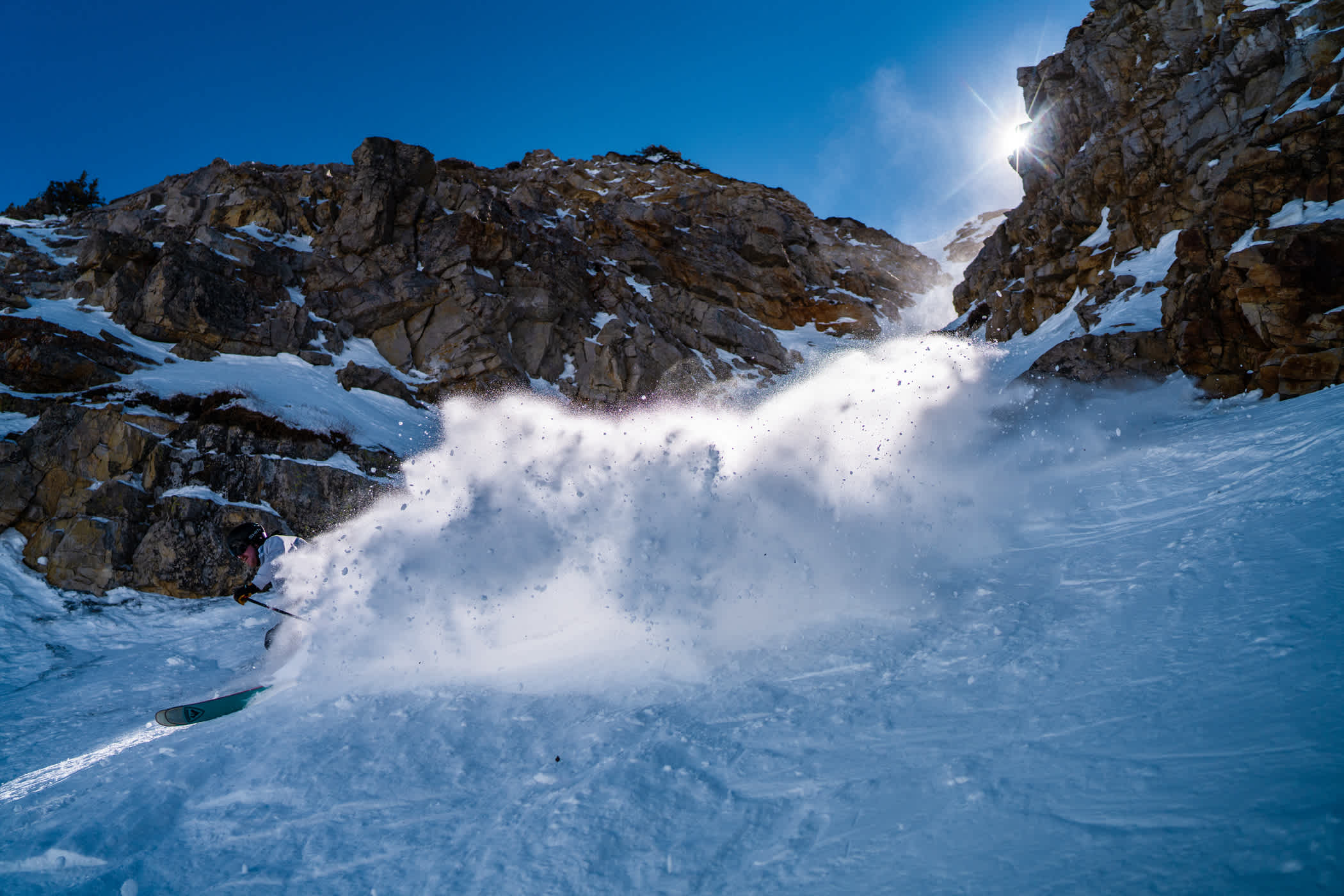
February 18th Storm Skiing
On February 18th, it snowed 29.5 inches in 24 hours. That was the third-biggest 24-hour snowfall at Alta in the past 21 years.
- March 30, 2005: 31.5 inches
- April 3, 2023: 31 inches
- February 18. 2026: 29.5 inches
February 18th: Blake Wilson storm skiing| Photo: Rocko Menzyk
Takeaways From the Best Worst Season.
We didn't have many opportunities to link our powder 8s, but the timing of our biggest storm cycles helped get us through the season. A dense, base-building storm in early December allowed us to fire up the lifts and offer some off-piste skiing. We received fresh snow throughout the holiday season and a big storm cycle during the busy President's Week. A series of cold winter storms broke our three-week Spring Fever, allowing us to stay open daily through a snowy Closing Day of our 88th season.
It Was a Warm Winter
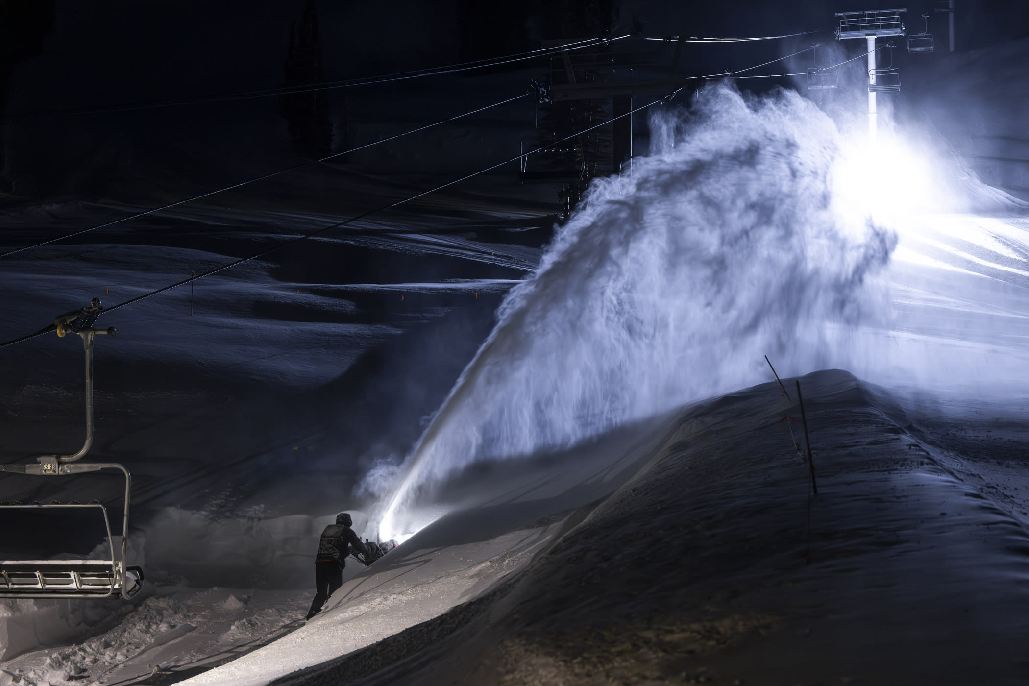
Temperatures stayed above average for most of the season. In October and November, the warmer weather melted early-season snowfall and severely restricted our ability to make snow. The average wet bulb temperature during our snowmaking year (October–December) was 23 degrees. During the 2024–25 snowmaking season, the average wet bulb temperature was 13 degrees. Thanks in large part to the warmer weather, Alta's snowmaking teams were only able to use 50% of the water allotment.
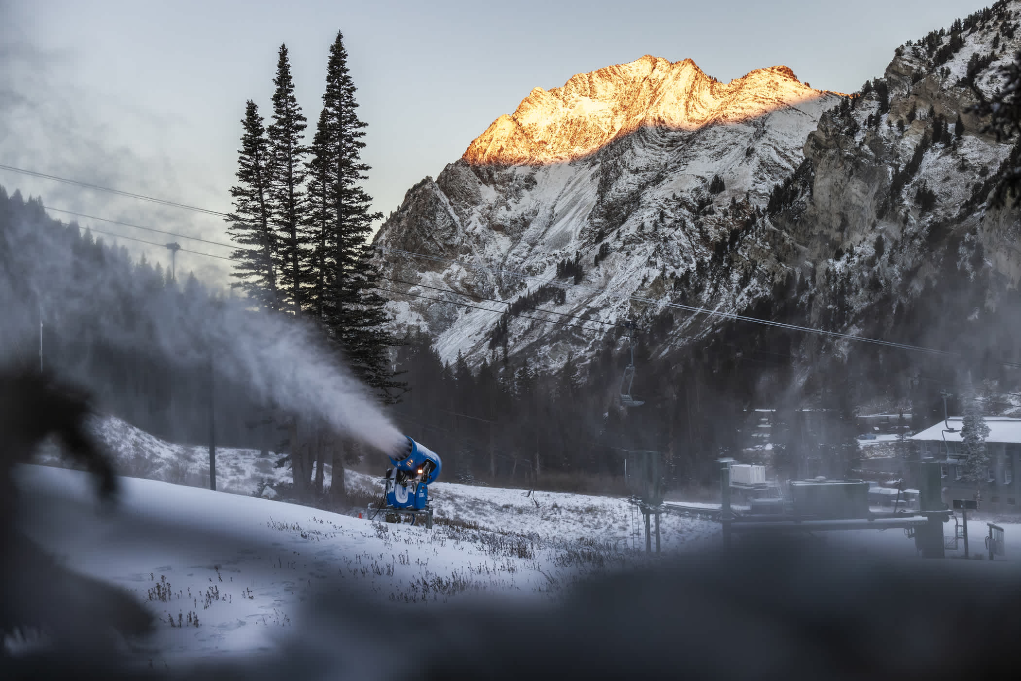
October 28th: Firing up the snowguns for the season | Photo: Rocko Menzyk
While our season-to-date snowfall was 59% of average, our season-to-date water was 80.4% of average. Warmer storms throughout the season delivered plenty of dense snow and graupel to our snowpack. The additional density has helped our settled snow depth hold up during long stretches of high pressure.
Many of the storms that reached the Wasatch arrived via a southwest flow. These types of storm patterns provide great base-building snowfall, but the snow is denser and snow levels are often high. A lot of storms this season began with snow levels around 8,500 feet, Alta's base area elevation.
April 21st: Alta's base area snowpack hanging on through the final week of the season | Photo: Photo-John
Over the past 45 seasons, the Collins Study Plot has recorded an average snowfall density of 8.36%. This season's snowfall averaged a whopping 11.35%—the first season in the past 46 years to register an average snowfall density above 10%. Warmer temperatures played a big part in suppressing seasonal snowfall totals. With average temperatures, we would have expected 440 inches of snow from 36.77 inches of water.
And then it got warmer
The prolonged heatwave that settled above the West in March was rough. In what is typically Alta's snowiest month, we endured unseasonably warm temperatures and a 25-day snowless stretch. In the midst of an early spring break, temperatures stayed above freezing for 10 straight days. The snowpack deteriorated quickly.
March 28th: Alta employees battling the heat | Photo: Tyler Struss
Our hardworking Slopes and Surfaces team did everything they could to move snow and put down a clean surface each night. The rest of our employees helped maintain ramps and building entrances, while volunteering on shovel projects to keep the lifts spinning and the mountain open.
Thank you to our dedicated and talented employees for their hard work and perseverance throughout this challenging season.
The Skiing Was Pretty Great
From Opening Day through the final chair of the season, the skiing was consistently great. It wasn't a deep winter, but thanks to early-season terrain openings and some well-timed storms, we were able to enjoy every inch of snow that fell from the sky. The dense snow helped create a solid settled snow depth—particularly at higher elevations where the snow stayed chalky and cold between storms.
February 4th: Jenna Henry makes chalk art on Alf's High Rustler | Photo: Tyler Struss
Despite the historically low snow totals, 95–100% of our terrain was open daily since the New Year. Westward Ho, Catherine's Area, Ballroom, Baldy Shoulder and the High Traverse opened in early December. The Backside, Devil's Castle, East Castle and East Baldy opened in January. Mount Baldy opened on February 2nd.
January 9th: Aaron Rae skis Baldy Shoulder on a bluebird powder day | Photo: Rocko Menzyk
Our Slopes and Surfaces crew worked their tails off, laying down fresh corduroy each night and adding new runs to the daily grooming report. Our hardworking employees pitched in to move snow and keep the lifts spinning.
March 27th: A new skier enjoying another sunny day | Photo: Rocko Menzyk
Extended periods of sunshine, blue skies and mild weather were an inviting environment for new skiers and weekend warriors. Logistically, Highway 210 only closed once during the season and Interlodge orders were few and far between.
Other Worst seasons
The 2025–26 season finished 2.5 inches below the 2014–15 season, claiming the title of least-snowiest on record. But was it truly the worst winter?
1976–77: the 1976–77 season—or really just the 1977 season—is considered one of the worst seasons ever. The season occurred before the introduction of snowmaking at Alta Ski Area, and due to mild temperatures and minimal early-season snowfall, Alta didn't open until January 5th. The season also predates the Collins Study Plot, but the nearby Alta Guard Station—located at 8,600 feet in the Town of Alta—recorded 314.5 inches of snow from just 23.7 inches of water.
- This season, the Alta Guard Station recorded just 213 inches of snow from 29.14 inches of water, 100 fewer inches at Alta's base elevation, but more with 23% more water. And an extra month of skiing.
1987–88: the back-to-back dry seasons of 1986–87 and 1987–88 have something to say. The 1986–87 season recorded 354.5 inches of snow from 27.31 inches of water, claiming the title of driest and least-snowiest season at the Collins Study Plot—until the next season.
The 1987–88 season recorded 353.5 inches of snow from just 25.16 inches of water—an average density of a dry 7.12%. The settled snow depth topped out at 103 inches on March 10th. The Utah Avalanche Center summed up the winter in their annual report:
"The 87-88 season, for the second year in a row, was a season most winter recreationalists would rather forget. Not that there weren't some high points, but they were easily forgettable, and scattered sparsely, as they were, between often long periods of dull avalanche activity and horrid skiing conditions. The season started with a whimper, ended with a sigh and fell asleep a couple of times in the middle."
2014–15: the 2014–15 season recorded 323.5 inches of snow from 27.98 inches of water—an average density of a very average 8.65%. The season started fairly average, with 162.5 inches by January 1st—compared to the average season-to-date snowfall of 187 inches. But then averaged just 30 inches per month in January, February, March and April.
The settled snow depth topped out at 95 inches on April 15th.
- The 2025–26 season recorded just 74 inches by January 1st, then averaged 62 inches per month in January, February, March and April. The settled snow depth topped out at 114 inches on March 7th.
Celebrating our 88th season.
Entering our 88th year, we envisioned a season of fresh tracks and celebratory powder 8s leading up to the return of the Alta Ski Area Powder 8 Championships for the first time in 28 years. Mother Nature had other plans.
As the Best Worst Season went on, we found ourselves waiting for winter to arrive—and then to stick around for more than a few days. Under a March heatwave, as ski resorts across the West were forced to close early, we weren't sure if we would make it through Closing Day of our 88th season. Right when we needed it the most, a cold April storm arrived—reversing the melt-out, ensuring we would keep the lifts spinning and giving us one final opportunity to hold the Alta Ski Area Powder 8 Championships in celebration of our 88th season.
April 3rd: Alta Ski Area Powder 8 Championships | Video: Sweetgrass Productions
When the dust settled, the Alta Ski Patrol team of Andrew McCloskey and Caroline Dillon were crowned the victors of the first Powder 8 Championships in 28 years—and a few anxious months. It was a reminder that even on the least-snowiest winter on record, there will still be bluebird powder days.
On a big year, or even an average year, it’s easy to show up and enjoy the fresh snow. On a uniquely bad season, there’s something rewarding about studying the wind, sun angle and aspect of a slope while searching out the terrain that’s skiing best on a given day. Aside from a handful of days each season, there's usually something skiing well at Alta.
It’s years like our 88th season that help us appreciate fresh snow, find the joy in exploring new terrain and celebrate sliding around on snow with family and friends. It helps us discover a newfound appreciation for this place we call home.
If this is as bad as it gets, we have it pretty good.
Add Your Comment