Alta's three Most
Underrated Hiking Trails.
Just 30 miles east of Salt Lake City, wildflower-filled meadows and scenic vistas have made Alta an accessible and beloved summer destination. But beyond the popular paths and bustle of Albion Basin and Cecret Lake, lie a handful of overlooked trails with additional stunning scenery and fewer people. These three underrated trails are a great way to uncover Alta's hidden gems and surely deserve a spot on your summer hiking bucket list.
As you set out on your adventure, please remember that we are all guests in Mother Nature's home and it is our responsibility to treat the host with respect. Help preserve these special places by respecting wildlife and wildflowers, treading lightly and leaving the landscape better than you found it.
Lower Albion Meadows
Starting Point: Wildcat base area
Trail Snapshot: Easy | one-mile loop | 100 vertical feet
Highlights: Wildflowers, interpretive signage, creek views and shaded sections
Lower Albion Meadows (#1 on the Summer Trail Map) is the perfect choice for hikers seeking a relaxed option without sacrificing scenery. This family-friendly route traverses through colorful wildflowers alongside Little Cottonwood Creek, with just 100 feet of elevation gain.
Wildflowers and views on the Lower Albion Meadows trail | Photo: Rocko Menzyk
The trail begins at the Wildcat base area, where hikers have access to free parking, restrooms, drinking water, trail maps and visitor information in the Skier Services building. As you head east, you'll stroll through vibrant meadows beneath Alf's High Rustler—one of Alta's signature ski runs—and travel parallel to what was once the main drag of Alta's historic mining town. Along the way, interpretive signs share fascinating insights into Alta's history, geology, natural resources and watershed.
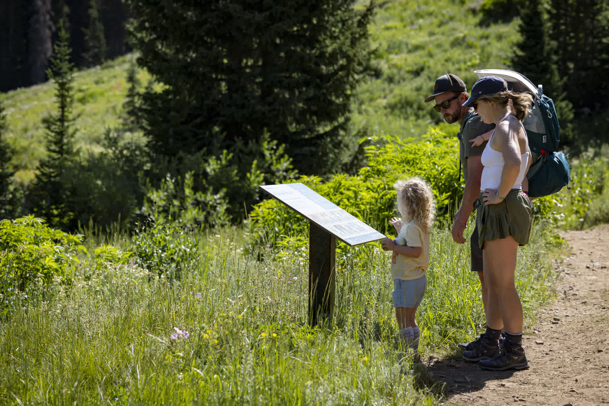
Interpretive signs along the Lower Albion Meadows trail | Photo: Rocko Menzyk
As the trail comes to an end at the historic Landes Memorial Jump Hill, you'll have some choices to make—turn around and return to Wildcat to complete the one-mile loop, continue east toward Albion base area along the Transfer Tow or take the scenic route beyond a waterfall into Albion Basin via Snake Pit Trail.

Lower Albion Meadows heading east | Photo: Rocko Menzyk
Whether you're hiking with kids, introducing friends to Alta's summer landscape, or simply enjoying a peaceful stroll, the Lower Albion Meadows trail is a great way to start and end your adventure in the mountains.
Snake pit
Starting Point: Albion base area
Trail Snapshot: Intermediate | 0.7 miles | 365 vertical feet
Highlights: Waterfall, wildflowers, creek views and shaded sections
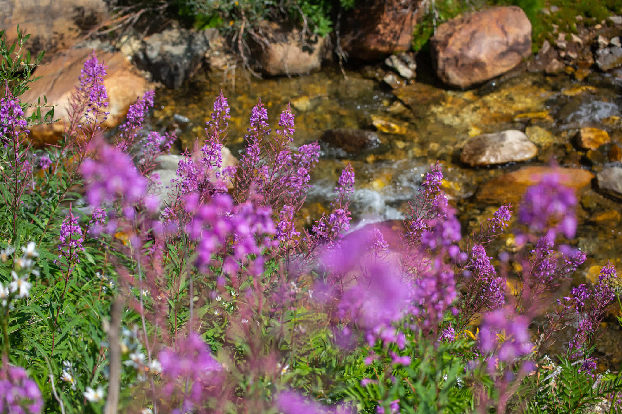
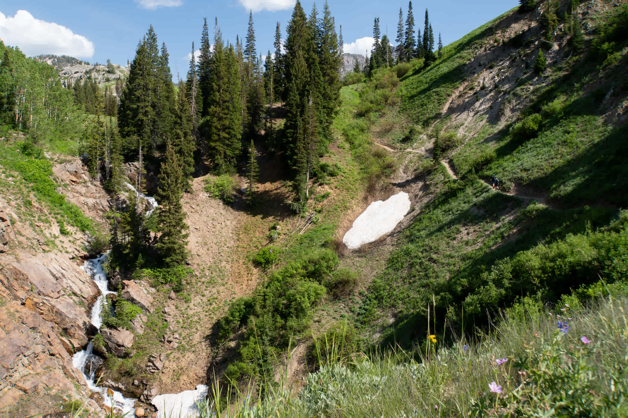
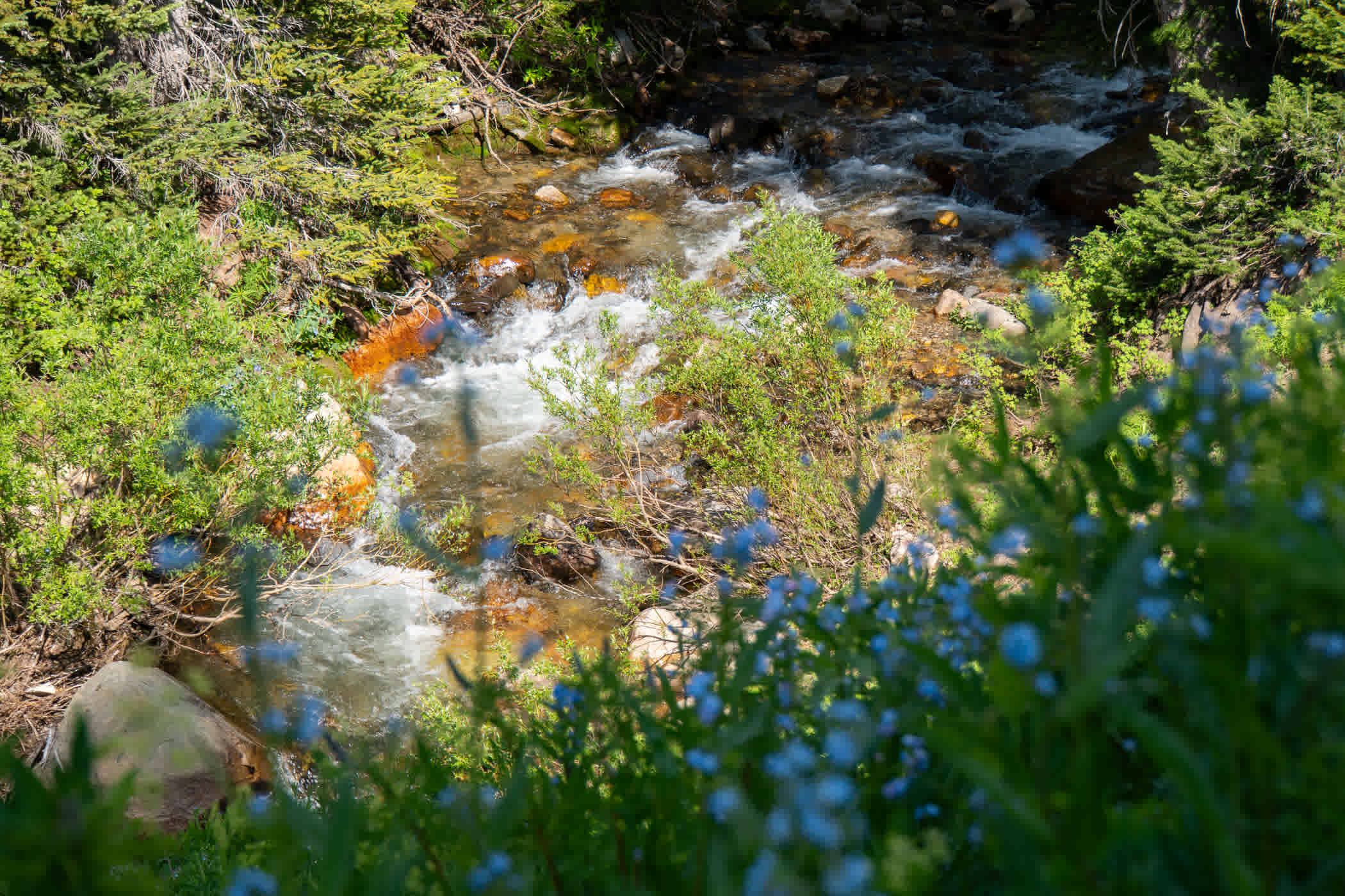
TLC told us not to go chasing waterfalls, but Snake Pit (# 7 on the Summer Trail Map) makes a pretty compelling argument otherwise. If you're heading into Albion Basin—or simply looking for a scenic walk along the water—we encourage you to take the road less traveled. This intermediate trail follows Little Cottonwood Creek through wildflower meadows and shaded switchbacks, gaining 365 feet of elevation over 0.7 miles.
Little Cottonwood Creek waterfall flowing alongside Snake Pit | Photo: Adam Fehr
To begin your journey, enjoy free parking at the Albion base area and stop by the kiosk to check the map as you fill your water bottle and use the restroom before hitting the trails. From here, head west along the Transfer Tow for a short distance until you reach the Snake Pit trailhead on your left. Once you approach the junction of Snake Pit and Lower Albion Meadows, take a moment to check out the historic Landes Jump Hill—built in 1947 to accommodate the growing sport of Gelande ski jumping. The site now serves a very different purpose today, as it houses Alta's on-site sawmill, where the summer trail crew repurposes hazard and fallen trees into benches, tables, furniture, snowfences and other woodworking projects found throughout the mountain.
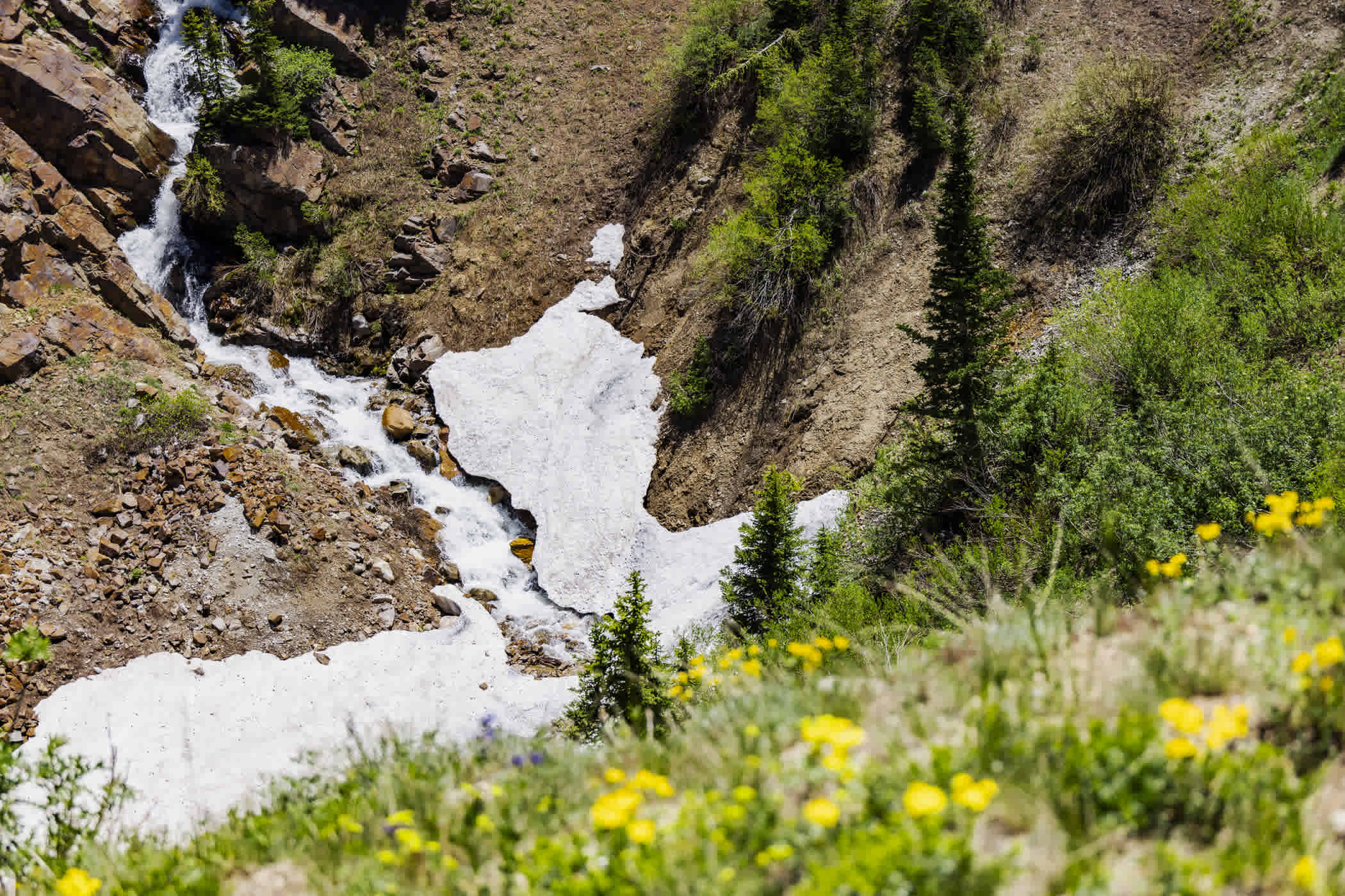
As the forest opens up, you'll find views of a waterfall rushing through the ravine below. Framed by Devil's Castle and Sugarloaf Peak in the distance, this is the perfect place to pause, take in the scenery and enjoy the peaceful soundtrack of cascading water.
Little Cottonwood Creek running through Snake Pit | Photo: Rocko Menzyk
From there, the trail returns to the shade before reaching another junction in lower Albion Meadows. Here, you can choose your next adventure—make your way back to the base area or continue deeper into Albion Basin via the Upper Albion Meadows trail to the left or the Home Run trail to the right.
Twin Lakes Pass
Starting Point: Town of Alta, Alta-Brighton Trailhead
Trail Snapshot: Hard | 2.1 miles | 1,350 vertical feet
Highlights: Early-season wildflowers, 360-degree mountain views and mining relics
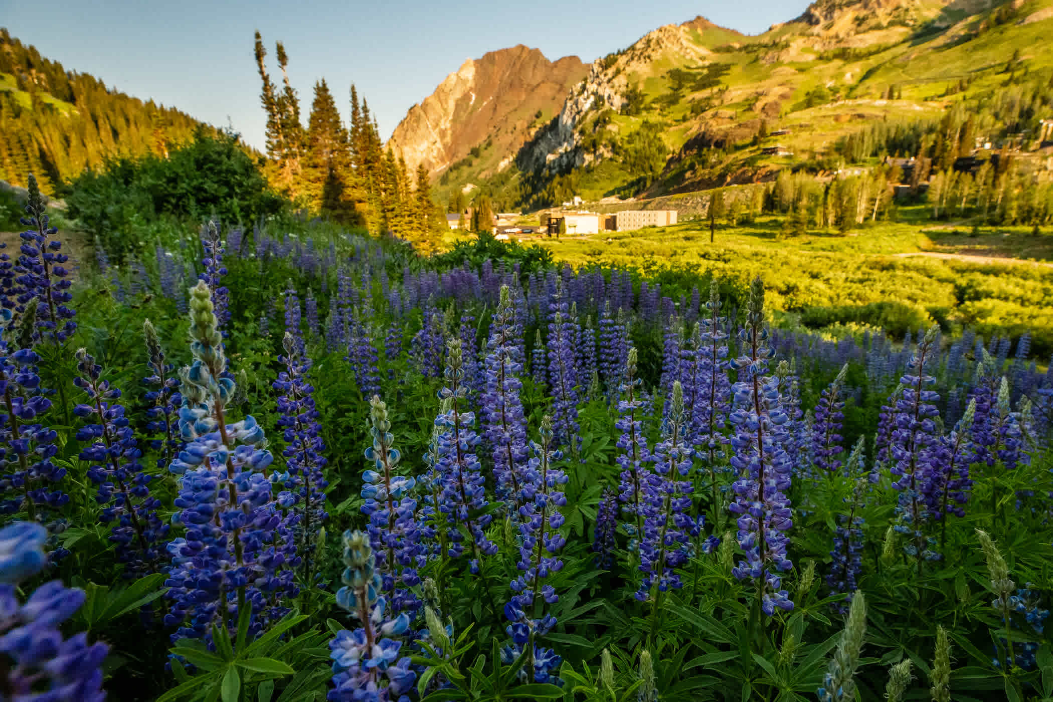
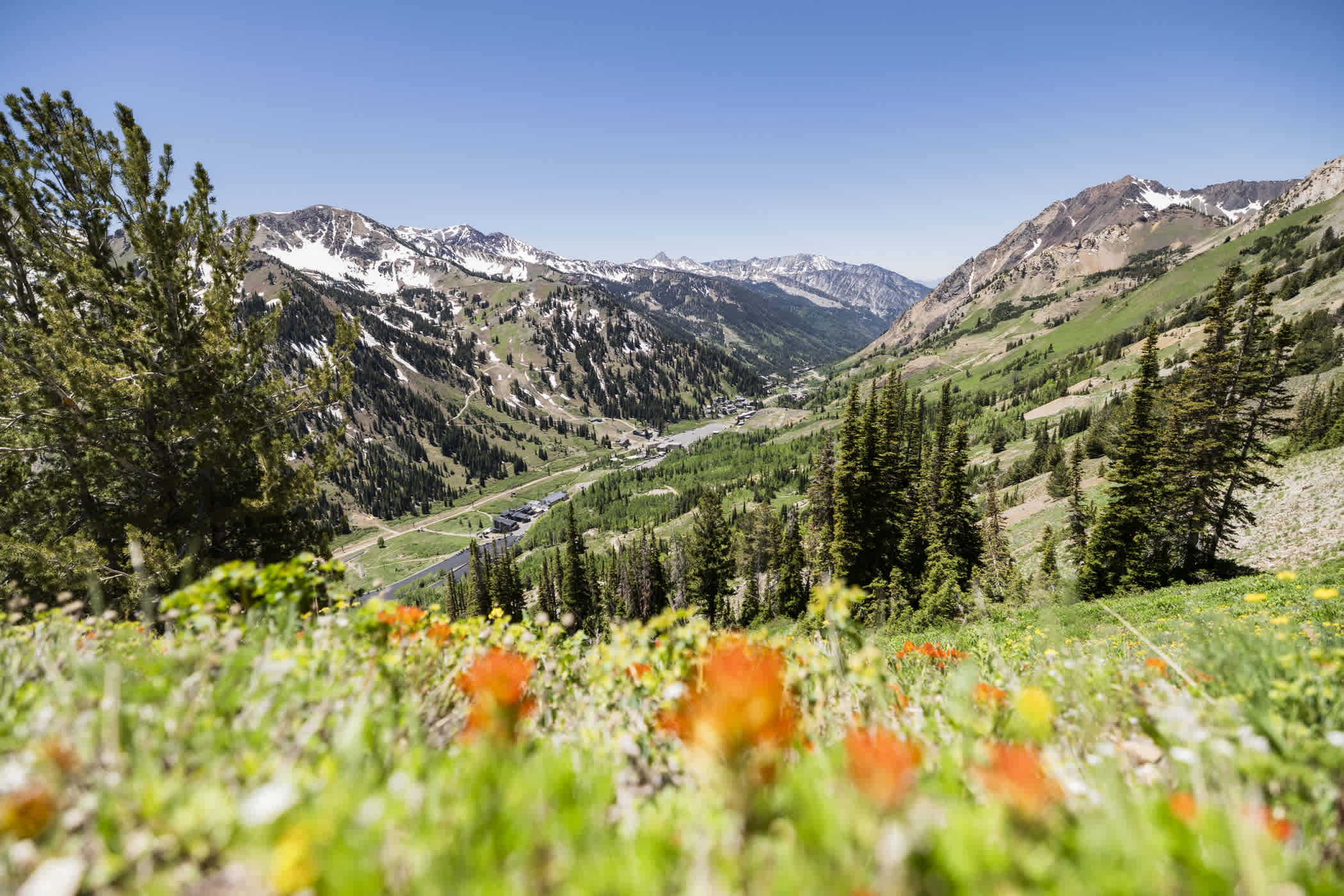
Looking to avoid the crowds of Albion Basin altogether? Head across Highway 210 to Twin Lakes Pass (#8 on the Summer Trail Map), a trail that delivers breathtaking scenery, vibrant wildflowers and fascinating glimpses into Alta's mining history.
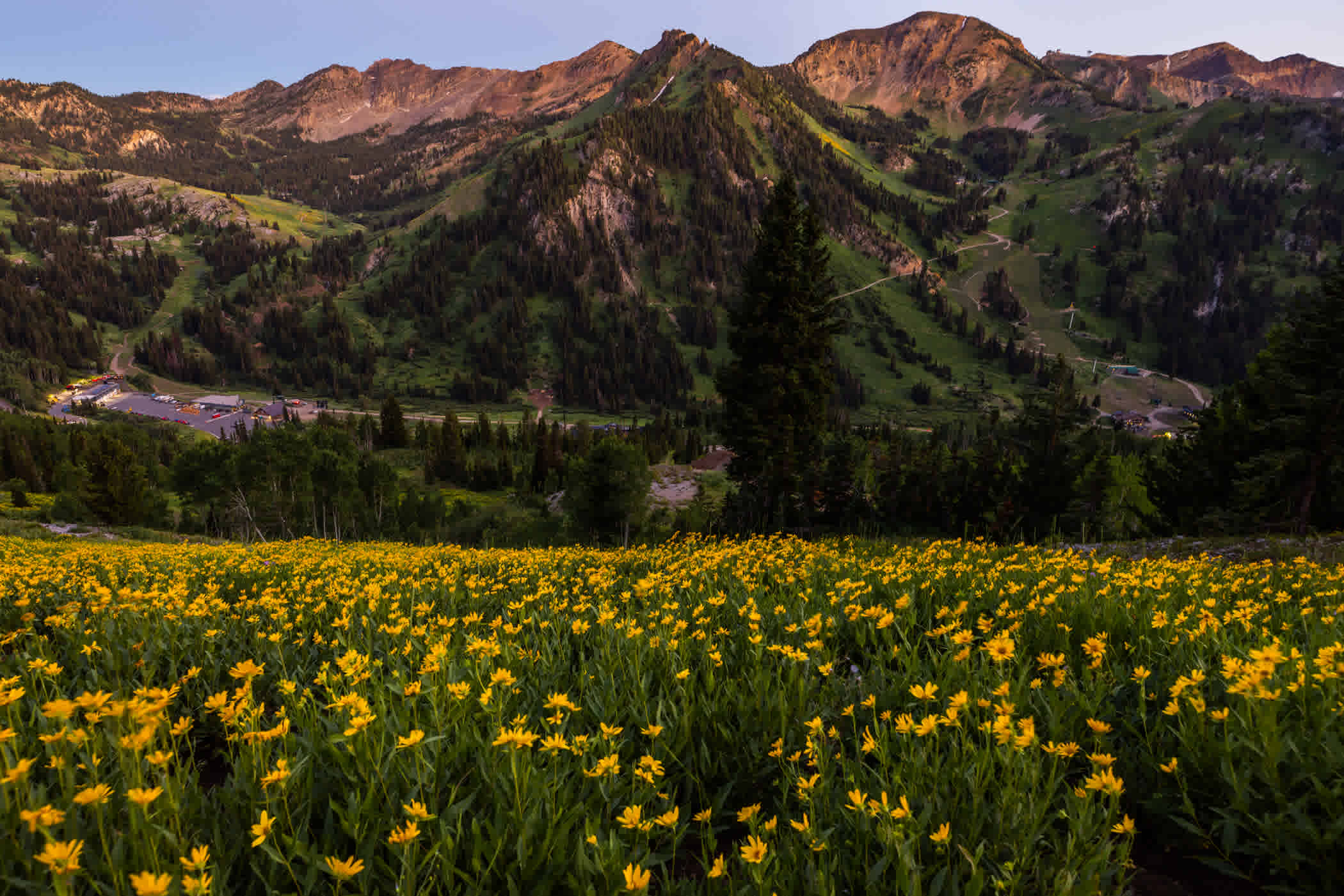
Views of Alta Ski Area from the Twin Lakes Pass trail | Photo: Rocko Menzyk
Begin by parking for free in the Town of Alta—across from Snowpine Lodge—at the Alta-Brighton trailhead. You'll climb through aspen groves on a series of steep switchbacks before reaching the historic Michigan City Road—the primary route used by miners traveling through the canyon in the late 1800s. From there, you'll head east to continue your journey along this former mining route toward Twin Lakes Pass.

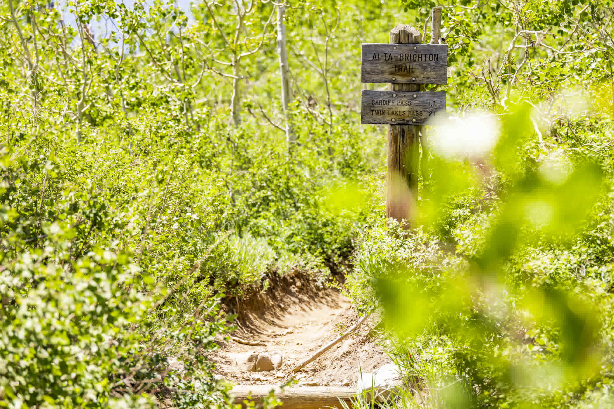
Twin Lake's Pass trailhead starting in the Town of Alta | Photo: Rocko Menzyk
As the trail climbs higher, you'll encounter remnants of Alta's Wild West era—including piles of old mine tailings, tram cables, abandoned equipment and the remains of mining structures. While these mining relics offer a unique window into Alta's past, please enjoy them with your eyes—not your hands—so they can be preserved.

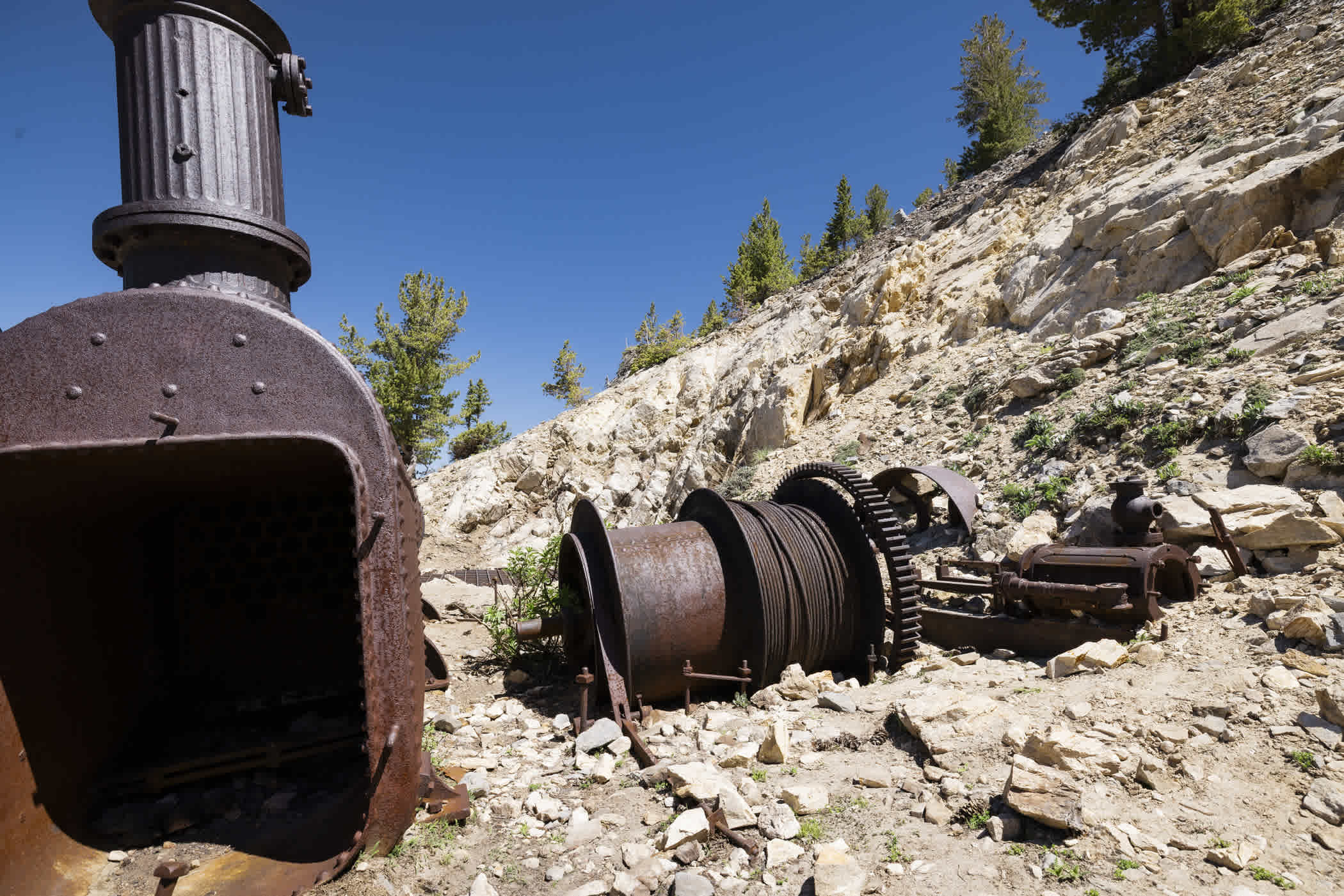
Old mining relics found at the Prince of Whales Mine | Photo: Rocko Menzyk
From Twin Lakes Pass, you'll enjoy sweeping 360-degree views of the Wasatch Mountains, with Twin Lakes shimmering below and ridgelines stretching in every direction. From here, the adventure can continue however you'd like—venture into Big Cottonwood Canyon, explore Davenport Hill or simply wander the trails along the ridgelines.
Views of Alta Ski Area, Mount Superior and Little Cottonwood Canyon | Photo: Rocko Menzyk
After a day on the mountain, head back into town and cap off your adventure with food and drinks at Snowpine Lodge or Alta Lodge.
Hiking Alta 101
As you explore Alta this summer, remember that we are all stewards of these mountains. Little Cottonwood Canyon is a protected watershed that provides up to 15% of Salt Lake City's drinking water, and its wildflowers, wildlife and alpine ecosystems depend on all of us to help care for them. While much of Alta is public land within the Uinta-Wasatch-Cache National Forest, there are also private parcels throughout the canyon. Please respect private property and stay on designated roads and trails. Motorized vehicles are not permitted on trails.
A few simple ways to help protect this special place:
- Stay on designated trails and roads—cutting switchbacks leads to erosion and loss of wildflowers and sensitive alpine vegetation
- Remain on designated trails even when taking photos
- Leave No Trace—carry out everything that you bring in
- Refrain from picking wildflowers or damaging plant life—it is illegal to pick flowers in Albion Basin
- Do not disturb the wildlife—for their wellbeing and your own safety and the safety of others
- Respect the watershed—no swimming or wading in Alta's alpine lakes and streams
By treading lightly and respecting the landscape, we can help keep Alta healthy and beautiful for generations to come. Happy hiking!